UPDATED FOR 2024!
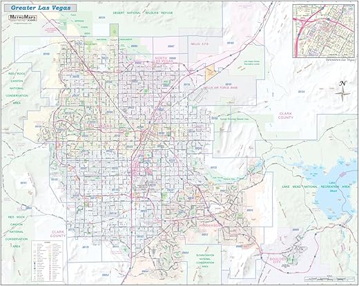
Sharp, functional, and up-to-date wall map of the Greater Las Vegas Valley / Clark County region, published by Metro Maps.
From Red Rock to Boulder City and Anthem to Aliante, this map offers a unique and comprehensive combination of detail and coverage.
Every street is shown, with all major roads labeled (including State and County highway designations). Freeways (with exit numbers), toll roads, passenger and freight rail lines + stations, airports, hospitals, colleges, parks, golf courses, primary schools (with high schools named), military installations, major points of interest (including all hotel/resorts) , major terrain features with subtle shaded relief, and current ZIP codes are all included.
45″x36″ and 55″x44″ sizes available. Paper or Laminated/ideal for dry-erase markers.


There are no reviews yet.